
 News 19 WLTX
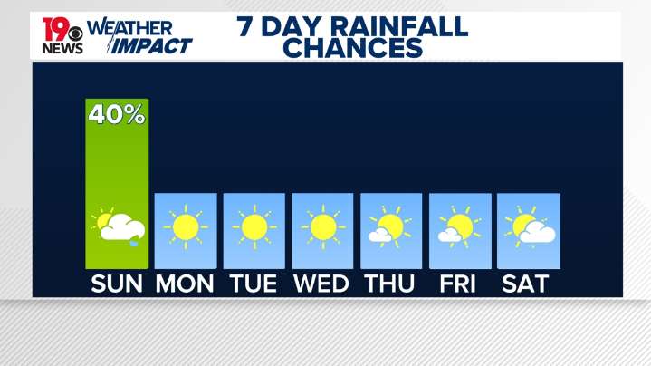
COLUMBIA, S.C. — After a taste of late summer heat across the Midlands on Saturday, cooler fall weather is set to make a return in the coming days.
Saturday night surface high pressure will continue to shift offshore. Skies will stay mostly clear with overnight low temperatures falling into the mid to upper 50s.
Sunday will begin dry, but will see increasing cloud cover through the morning. A cold front will cross the area through the evening on Sunday bringing breezy winds and the next chance for showers. Before the cold front arrives, high temperatures will reach the upper 70s to low 80s.
Wind gusts Sunday afternoon could reach 30-35 mph. The National Weather Service has issued a lake wind advisory for all of the Midlands beginning at 2:00 PM Sunday and lasting until 8:00 AM Monday.

 WIS News 10
 Vogue Culture US
 The Daily Beast
 Breitbart News
 America News