By Joe Lombardi From Daily Voice
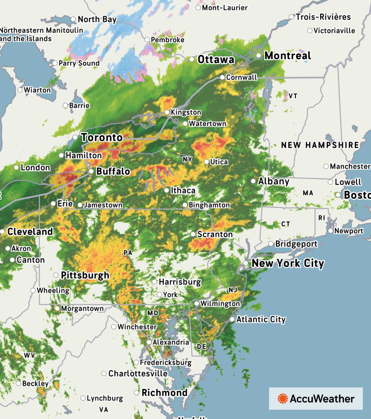
A powerful system containing scattered severe thunderstorms is set to drench the Northeast with heavy rain and gusty winds, raising the risk of coastal flooding and travel disruptions as October comes to a close.
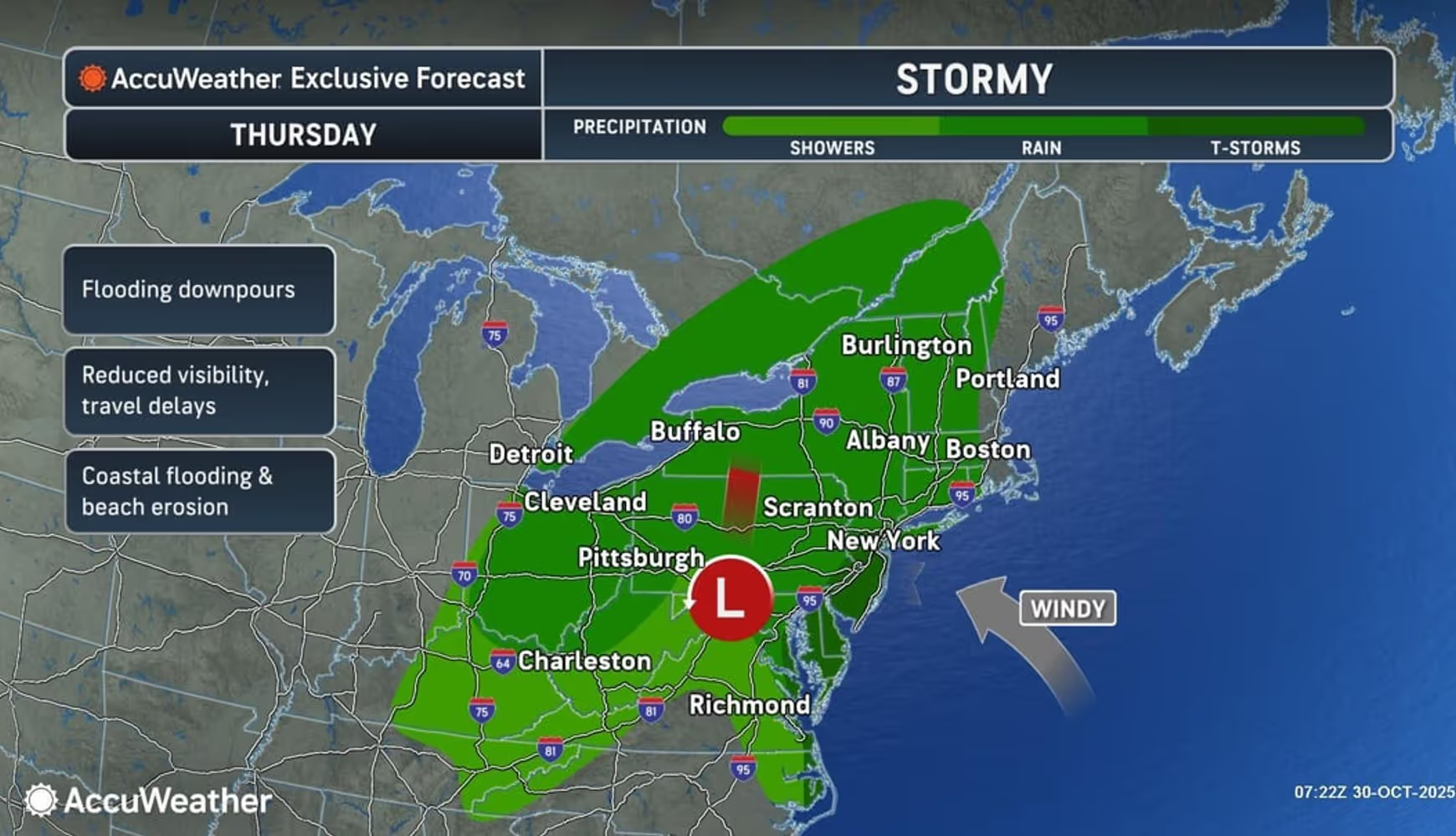
The National Weather Service says a strong frontal system and low pressure will bring steady rain and wind to the region on Thursday, Oct. 30, continuing into the evening.
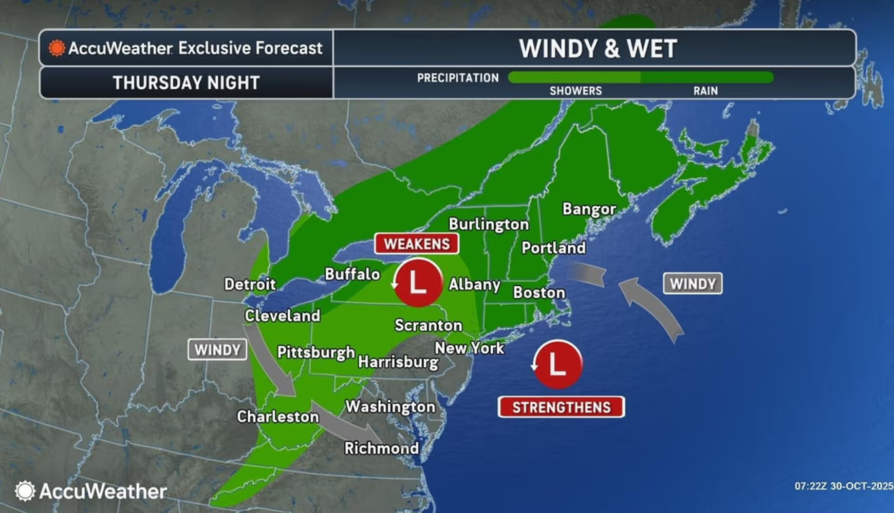
Rain will taper off late Thursday night, but winds will stay strong as they shift direction into Halloween on Friday, Oct. 31.
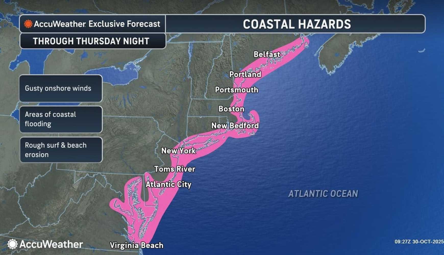
Persistent onshore winds are expected to raise water levels and cause coastal erosion, with moderate-to-major coastal flooding forecast along the East Coast.
“There will be consistent rain and wind on Thursday, Oct. 30 into Thursday evening," according to the National Weather Service, noting that the rain will taper off late Thursday night, but it remains windy as the winds switch direction into Halloween on Friday, Oct. 31.
AccuWeather meteorologists say this storm will not be considered a Nor’easter because it will track well inland over the Appalachians, rather than hugging the coast.
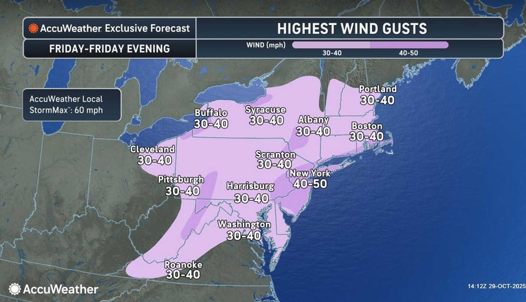
Gusts as high as 50 miles per hour will arrive Thursday evening, continuing throughout Halloween.
Winds will generally be from the east and southeast, but onshore flow will still create beach erosion from the Carolinas to New England.
“It will be a stormy end to October in the eastern United States, and the drenching rain will be followed by a long-lasting burst of chilly air," AccuWeather reports. "Some snow may even fly over the northern mountains,”
The wind’s effects on the water will lead to coastal flooding at high tide from Virginia to Maine.
The combination of fallen leaves and wet conditions will make roads extra slick, and blocked storm drains could cause street flooding.
As the storm lifts northward, a pocket of warm, humid air may spark thunderstorms in parts of eastern Virginia, eastern North Carolina, Delmarva and southern New Jersey on Thursday. Some storms could be severe, with gusty winds and torrential downpours.
Travelers should expect delays on highways and at airports from Washington, DC, to Philadelphia, Pittsburgh, New York City and Boston.
The heaviest rain and strongest onshore winds will focus on New England Thursday night. In an extreme scenario, cold air could rush in as the storm moves over Atlantic Canada, bringing several inches of snow to higher terrain from northeastern New York to northern Maine and southeastern Quebec as early as Thursday night.
After the storm passes, much colder air will settle in. “The weather pattern for the second half of the week and into the weekend will bring the chilliest nights and coolest days for much of the Southeast states since early April and late March,” said AccuWeather Senior Meteorologist Dave Houk.
Check back to Daily Voice for updates.

 Daily Voice

 New York Post
 KIMT News 3
 WISC-TV Channel 3000
 The Conversation
 New York Daily News Crime
 People Top Story
 WGRZ-TV
 K2 Radio Local