
 Hawaii News Now
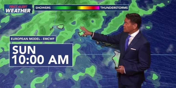
HONOLULU (HawaiiNewsNow) - An approaching cold front and an upper level disturbance will increase the chances for showers statewide, but especially for the western end of the island chain.
The forecast models show the front stalling to the northwest. However, the upper level trough will increase the possibility for isolated thunderstorms, scattered showers and locally heavy rain for Kauai and Niihau during the day Sunday.
The trough should travel to the west-southwest and away from the islands Sunday night into Monday. Lighter trades should then move in with showers once again, but it might still be a little humid on those days.
In surf, a high surf advisory remains posted for most north and west shores of the smaller islands. Right now the advisory is set to expire at 6 a.m. Sunday, bu

 Local News in Arizona
 Battle Creek Enquirer
 KSNB Local4 Central Nebraska
 NPR
NPR WIS News 10
 ClickOrlando
 KPLC
KPLC WWSB
WWSB The Herald-Times Online
 Mediaite