
 ClickOrlando
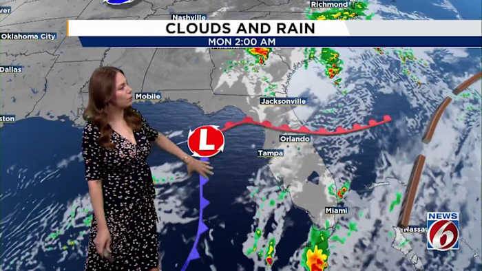
ORLANDO, Fla. – A gradual warming pattern has begun across Central Florida ahead of an strong upper-level low tracking towards the Sunshine State.
This system will help form a weak low-pressure area just off the Southeast coast, dragging a cooler front through our region later today into Monday.
Sunday-Monday
Sunday expect high pressure to remain in control, keeping winds light from the north to northeast at around 5–10 mph. Most areas will stay dry, though a few brief showers could pop up late this afternoon.
As the upper low gets closer late Sunday and into Monday, moisture levels will increase slightly, giving us a better shot at some isolated to scattered showers. Still, rain chances stay on the low side at about 20–30%.
Temperatures today will feel seasonable, with highs in the

 News Collection
 Women's Wear Daily
 AlterNet
 The Times Herald Sports
 Raw Story
 Pajiba
 Essentiallysports College Sports
 The Babylon Bee