
 The Bay City Times
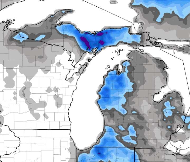
We continue to see a strong blast of December-like cold air heading through Michigan late this weekend and early next week. The combination of very cold air for early November, combined with still quite warm Great Lakes’ waters will make Michigan’s first authentic burst of lake-effect snow.
All of the model output continues to show the snow would be much more than just a few flakes.
We also have to remember the ground is still warm, and we still get air that warms up if a hint of sun comes out.
It will be hard to have a widespread, heavy snow on the roads, but it’s definitely something worth watching.
The weather scenario is a two-parter. On Sunday a storm system with an area of precipitation will move across the southern half of Lower Michigan and northern Indiana and northern Ohio. T

 KSNB Local4 Central Nebraska
 TIME
TIME KIMT News 3
 FOX 13 Seattle King County
 Eyewitness News 3
 KTLA
KTLA KKTV 11 News
 KPAX
KPAX K2 Radio Local
 FOX 32 Chicago
 First Alert 4 Sports