
 New York Post
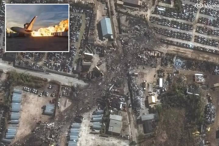
Shocking satellite images reveal the path of destruction left by the UPS cargo plane that crashed and bust into flames in Kentucky on Wednesday, leaving at least 12 people dead, including a child.
The before-and-after photos from Vantor, a satellite and data intelligence company, show a long black trail of scorched debris and torched vehicles at an industrial area just south of Muhammad Ali International Airport in Louisville.
The images also showed a massive 300-foot gash on the top of a UPS warehouse that was struck by the plane as it came down shortly after takeoff from the company’s aviation hub.
The crash sparked a massive inferno that consumed the enormous aircraft and spread to nearby businesses.
The jet was carrying about 50,000 gallons of fuel when it took off from the ai

 Raw Story
 Associated Press Top News
 Law & Crime
 Live 5 News Crime
 Reuters US Domestic
 Reuters US Top