
 WDHN News
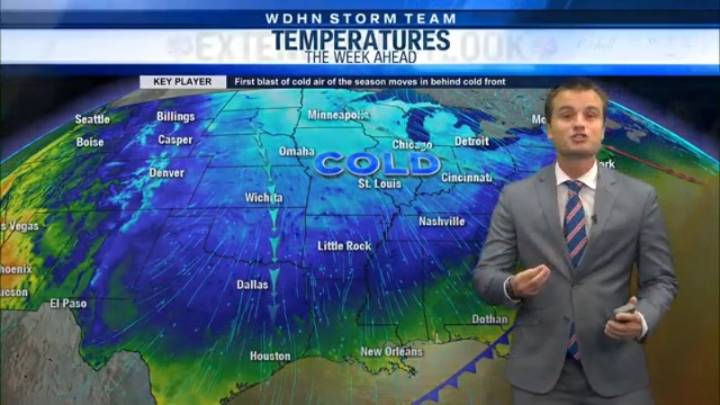
DOTHAN, Ala. (WDHN) — Springlike warmth will continue for another day in The Wiregrass before a major cooldown arrives.
For your Friday morning, we are starting off with temperatures largely in the 50s.
Numerous pockets of patchy to dense fog will continue through about 8 - 9 a.m. Afterwards, we will quickly warm up to the 80s.
As we approach the afternoon, rain chances will increase slowly. Stronger storms are possible overnight Friday and early Saturday. One or two could become marginally severe and produce damaging wind gusts up to 60 mph, but any severe weather would be very isolated.
Our warmth continues on Saturday before a powerful cold front moves through Sunday. Between Monday and Wednesday, lows will be in the 30s (or lower), with wind chills in the 20s at least through Tuesd

 CNN
CNN Newsweek Top
 Raw Story