
 WBRC
WBRC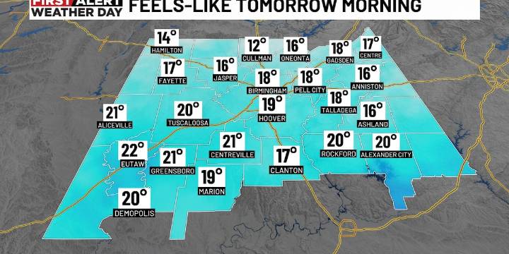
BIRMINGHAM, Ala. ( WBRC ) - FIRST ALERT WEATHER DAYS : The surge of much colder air has reached our area! Temperatures have already tumbled into the 40s north and temperatures will continue to fall quickly this evening as the colder air pours in. We could even see a few snow flurries or an isolated snow shower to the north and east later tonight. The main wintry precipitation concerns will be further north in the Smoky Mountains.
This is the first significant blast of cold air of the season, and this will bring lows in the upper 20s Monday morning, with low to mid 20s Tuesday morning. In fact, the entire state will experience a freeze Tuesday morning. Now is the time to make preparations! Make sure the pipes, pets, and plants are protected and check on those around you to make sure ev

 KWTX News 10
 Alabama Local News
 The Daily Beast
 The Federick News-Post
 Page Six
 AlterNet
 WFMJ-TV Sports