
 WREX
WREX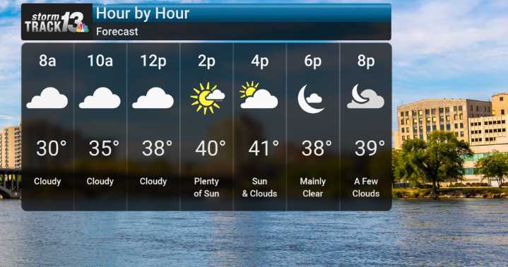
We're seeing the potential for some light snow or flurries this morning, with about a 20-30% chance. Don't expect much more than a quick dusting, though. We will be monitoring the chance for snow to transition over to some rain by midday as temperatures rise above freezing, with a high of 42 today.
We are expecting a significant warming trend to take hold as we push toward the end of the week. Westerly and southwesterly winds will be pulling in noticeably warmer and drier air from the southern Plains. By Friday, we're looking at highs potentially near the mid-60s, and Saturday is shaping up to be the warmest day of this stretch, with temperatures possibly reaching into the upper 60s, maybe even flirting with the low 70s in some locations.
Looking ahead to the weekend, we'll see a ridge o

 WMTV NBC15
 WSIL-TV
 WLFI News 18
 KSNB Local4 Central Nebraska
 WUSA 9 News
 WIS News 10 South Carolina
 CBS Colorado
 KSLA News
 NBC4 Washington
 WCCB Charlotte
 FOX 32 Chicago
 Vogue Living