
 21Alive News
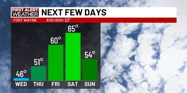
FORT WAYNE, Ind. (WPTA) - The snowmelt kicks off today as we gradually see more sunshine and temperatures rise into the weekend.
Despite some lingering clouds up north for the first half of the day, we’ll become mostly sunny. Highs will reach the mid 40s for Wednesday, but windy conditions will drag wind chills into the 20s and 30s. Wind gusts will pick up to 30 mph. The 50s and 60s will close out the workweek, looking great for Thursday and Friday!
Another front arrives this weekend, but it doesn’t look to impact your plans too much. We’ll be windy on Saturday ahead of our next cold front, bringing in a quick chance for a shower or two on Saturday night. We’ll be clear by Sunday as winds slowly die down. Temperatures will reach the mid 60s on Saturday, but we’ll return to the mid 50s on

 Raw Story
 WCPO 9
 E Online
 Billboard