By Joe Lombardi From Daily Voice
A quick-hitting storm is set to keep the Northeast in a wintry mood, with more snow and cold air moving in just as many residents experienced their first snowfall of the season.
The National Weather Service reports that a few flurries are possible across the Northeast on Wednesday, Nov. 12, Skies will stay mostly cloudy and conditions cool, a day after some there was accumulating snowfall in some locations while others saw their first flurries of the season.
According to AccuWeather, the latest blast of cold and snow dropped temperatures to record lows for November on Tuesday, Nov. 11, covering autumn leaves with a blanket of white.
“Snow shovels were needed around the Great Lakes and parts of the Northeast as snow piled up — the first accumulations of the season for many residents," AccuWeather said, noting as much as 18 inches of lake-effect snow fell in part of Michigan.
The cold air is set to stick around. A persistent southward dip in the jet stream will allow periodic, fast-moving storms to drop in from Canada, keeping much of the eastern third of the US chilly through the weekend.
A new clipper-style storm will roll through the region Wednesday, bringing another round of accumulating snow to the Adirondacks of northeastern New York and the Green Mountains of Vermont.
“A small slushy accumulation on top of what fell Tuesday is also possible in some areas of western and northern Pennsylvania and western and central New York,” according to AccuWeather. Cold air may also spark more lake-effect snow bands along the northern shores of lakes Erie and Ontario.
Further south, afternoon temperatures will rebound by about 10 degrees Fahrenheit from Tuesday’s highs in the mid-Atlantic and southeastern New England. Highs in the New York metro area will be within a few degrees of 50, which is 5 or more degrees below the historical average.
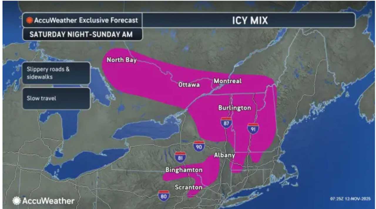
Looking ahead, another clipper storm is set to swing through the Northeast over the weekend, bringing similar cold and snow.
AccuWeather notes, “One difference will be a zone where an icy mixture is likely in parts of central and northern New England, eastern New York and part of northeastern Pennsylvania.”
Brisk to blustery conditions will linger as the quick-paced storm track continues, keeping wind chills low and the region’s taste of winter going strong.
Check back to Daily Voice for updates.

 Daily Voice

 New York Post
 NEWS10 ABC
 The Daily Beast
 People Shopping
 NBC News