
 WMTV NBC15
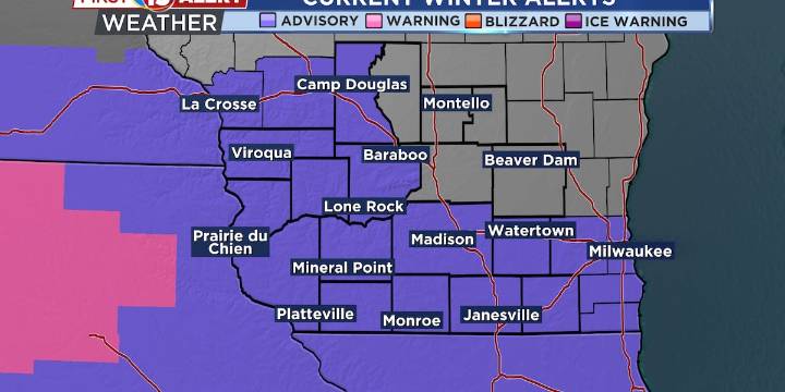
Snow is coming tonight through Sunday morning
It’s going to be cold
More snow possible next week
MADISON, Wis. (WMTV) -First Alert Day in place for a significant winter weather system is moving into the area this evening, bringing widespread accumulating snow through early Sunday morning. Southern Wisconsin will see the heaviest snow, with totals of 3″ to 6″ possible, while areas north of I-94 will receive 1″ to 4″. The Winter Weather Advisory has been issued for the southern half of the forecast area due to the confidence in this snow event. Snow will wind down early Sunday morning as the system moves east. Click Here for Interactive Radar
What’s Coming Up...
Temperatures will remain well below normal throughout the weekend and into next week. Sunday will be particularly chilly wit

 KIMT News 3
 Associated Press Top News
 The Daily Beast
 KCBD Sports
 Slash Film
 America News