
 Mirror
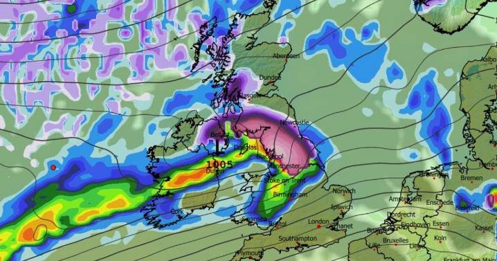
Snow looks set to fall across a massive chunk of the UK in the days before Christmas as advanced weather maps suggest some regions could see several inches
Advanced weather modelling maps show as many as three snowstorms could sweep across the UK in the days before Christmas , meaning the white stuff might still be on the ground by December 25.
Roughly half the country could be impacted by the Arctic blast , the GFS weather model suggests, with several inches of snow expected in some regions.
The wintry chaos looks set to get underway on December 20, with snow and rain falling as an Atlantic weather front sweep across the UK. Northern Ireland looks set to face the most intense flurries initially, before Wales , the Midlands, the north of England and Scotland also see some

 Daily Star Latest
 LeicestershireLive News
 Britain News
 America News
 New York Post Health
 Associated Press US News
 Atlanta Black Star Entertainment
 WBNS Columbus
 AlterNet