
 KCCI 8
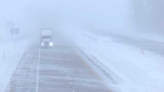
DES MOINES, Iowa —
We are entering a very active weather pattern with potential blizzard conditions Tuesday night and Wednesday morning.
We don't expect any new snowfall, but very strong winds will lead to a "ground blizzard" as the recent snowfall is picked up and blown around. Most of the state, which still has several inches of snow on the ground after back-to-back weekend snowstorms, will see wind gusts over 50 mph overnight.
Hearst Owned Very strong gusts greater than 50mph expected overnight into Wednesday morning.
The strong winds will pick up the light and fluffy snow we had last weekend, which will lead to reduced visibilities for an extended period of time, along with significant drifting.
Hearst Owned Blizzard criteria
Travel becomes treacherous with partially and comp

 KCRG Iowa
 WIRED
WIRED SI NBA
 Desert Sun Sports
 ABC30 Fresno World
 Raw Story
 The Daily Mining Gazette