
 PennLive Pa. Politics
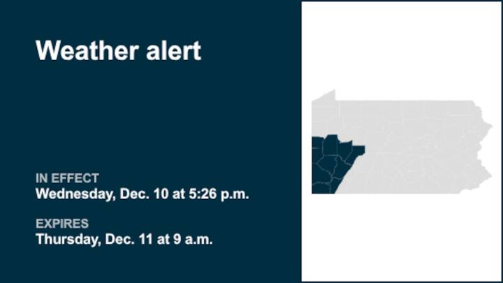
A special weather statement was released by the National Weather Service on Wednesday at 5:26 p.m. until Thursday at 9 a.m. for Lawrence, Butler, Beaver, Allegheny, Armstrong, Washington, Greene, Westmoreland, Fayette and Indiana counties.
"As a cold front crosses the region, temperatures are expected to fall to or below freezing by late evening, and then into the lower to mid 20s by sunrise. Any lingering water on untreated roads is likely to freeze, potentially creating slick spots. Also, rain showers will change to snow showers tonight. Accumulations should mostly remain an inch or less, but any snow accumulation on roads could add to potential driving hazards into the morning commute. Motorists should use caution on the roads tonight and through Thursday morning. Allow for a little ex

 Syrancuse.com
 SIAdvance
 The Oregonian Public Safety
 KOIN News
 KKTV 11 News
 AccuWeather Severe Weather
 WIS News 10
 ABC 6 WPVI-TV
 KETV NewsWatch 7
 WMTV NBC15
 KOMO News
 The Daily Beast