
 Idaho News 6
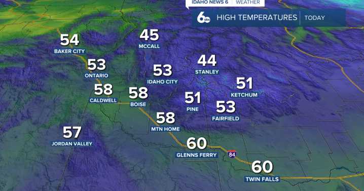
Idaho News 6
The warm and dry pattern continues across southwest Idaho as a broad ridge of high pressure remains locked over the western United States. This ridge has kept storm systems deflected to our north, allowing an atmospheric river to feed moisture into Washington and northern Idaho while our region stays mostly dry. With light winds and a surface inversion in place, valleys are experiencing periods of stagnant air that are expected to linger through at least Sunday night.
Temperatures remain unusually mild—running about 15 to 20 degrees above average—but daytime highs won’t be quite as warm as they were midweek.
Looking ahead to early next week, above-normal temperatures continue as high pressure holds strong over the Intermountain West. The ridge shifts east on Sunday, allowin

 NECN Providence
 The Oregonian Public Safety
 KOIN News
 Eyewitness News 3
 NBC Connecticut
 KKTV 11 News
 AccuWeather Severe Weather
 Syrancuse.com
 WIS News 10
 Raw Story