
 cleveland.com
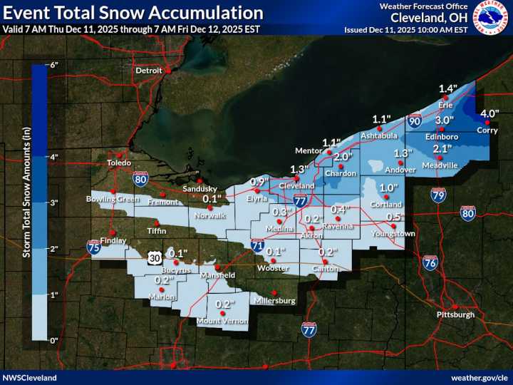
CLEVELAND, Ohio — Lake-effect snow will dominate the weather across Northeast Ohio on Thursday, with additional light accumulations and lingering slick spots expected as colder air continues to flow over Lake Erie.
A narrow, fast-moving band of lake-effect snow swept from Lorain County toward the Interstate 480 corridor early Thursday, reducing visibility and leaving a quick coating on roads. With the bulk of that burst now past, forecasters expect scattered snow showers — especially in the snowbelt — to continue through the day and into Friday.
Most communities can expect an additional 1 to 3 inches of snow through Friday afternoon, according to the National Weather Service in Cleveland . The most persistent bursts will focus on Geauga and inland Ashtabula counties.
Highs across the

 Cleveland Jewish News
 Cleveland 19 News
 News 5 Cleveland
 AlterNet
 NBC 7 San Diego Entertainmet
 Edmonton Sun World
 DoYouRemember?
 Raw Story