
 WREX
WREX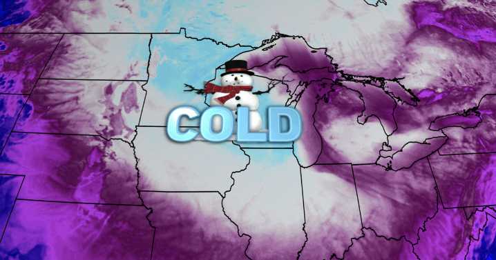
An even stronger wave of arctic air is set to sweep across the Midwest this weekend, setting up dangerously cold wind chills that thankfully don't last very long.
As a clipper system drops snow largely to our south across central Illinois through Friday morning, we do have a couple more opportunities for a little snow locally. First, some flurries after dark Friday evening may cause a dusting, then another clipper system passes well to our south on Saturday, again bringing a dusting as far north as U.S. 30 (Sterling, Amboy).
The big story is an arctic blast led in by a cold front Friday afternoon. Temperatures tank from the mid 20s to the single digits (above 0°) Saturday morning. Wind chills will stay below 0° all weekend and reach dangerously cold levels Saturday night.
Clouds clear o

 Lehigh Valley Live
 Duluth News Tribune
 KY3 Sports
 The Atlantic
 America News
 5 On Your Side Sports
 Raw Story
 CNN Politics
 5 On Your Side Crime
 WVTM 13 Entertainment
 AlterNet
 Cleveland Jewish News