
 WAND TV
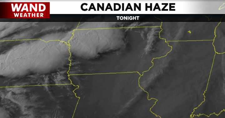
(WAND) - Canadian wildfire haze has been around central Illinois, of varying degrees, since last Friday. While the smoky layer never mixed down to the ground, we should finally start to see a change; kind of.
You see, the thin layer of haze will be ushered out toward the east, but it will quickly be replaced by upstream clouds. Note the two graphics above. Thunderstorm clouds are doing a couple things. The outflow from the storms is creating a small, albeit crucial, wind shift line to their east. This shift in the wind will allow the haze to exit into Indiana as the night wears on. However, the high clouds blowing off the big thunderstorms will arrive to replace the haze. Either way, dry weather lingers for one more night.

 THV11 Arkansas
 The Baltimore Sun
 SIAdvance
 Salon
Salon HuffPost Crime