
 WEVV 44News
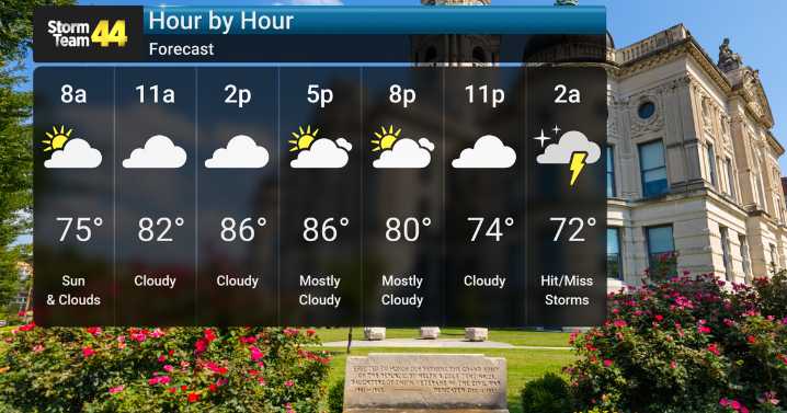
An active weather pattern is setting up over Southern Indiana, bringing with it multiple rounds of thunderstorms and heavy rain chances from this afternoon through early next week. We're looking at a few showers possible today, then thunderstorms becoming likely tonight after 10 PM, Thursday and Friday.
While severe weather is possible each day, Friday afternoon holds the highest risk for damaging winds. Heavy downpours are expected, with rainfall totals of 1-2 inches possible through Friday night. This could lead to localized flooding issues. Shower and thunderstorm chances continue into the weekend and early next week, albeit with lower probabilities. Temperatures will remain seasonably warm, in the low 80s.
After Friday, we should see some drying out and partial clearing, with tempera

 WACH Fox
 KOAA News5
 KRDO NewsChannel 13
 TODAY Video
 IMDb TV
 The US Sun Latest
 FOX News Politics
 Political Wire