
 WREX
WREX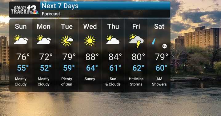
Tonight across Northern IL, showers and a few thunderstorms will develop, which are expected to persist through the first half of the night. The heaviest axis of rain will be south of I-88. Overnight, temperatures will settle into the comfortable upper 50s.
As we head into Sunday and Monday afternoons, the weather pattern remains somewhat unsettled, with isolated to scattered showers moving through the area. There's a chance for some of these storms to be on the stronger side, potentially bringing pea to nickel-sized hail and wind gusts of 40 to 50 mph. On Sunday, expect high temperatures in the upper 70s as thunderstorms develop in the afternoon, with overnight lows in the mid 50s. Monday will see mostly cloudy skies and slightly cooler temperatures, with highs in the low 70s and lows in

 abc27 News
 KWQC
KWQC NBC10 Philadelphia Sports
 Wheeling Intelligencer