
 East Bay Times Public Safety
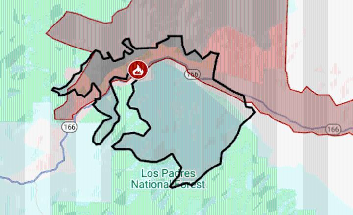
The Gifford Fire, which started Friday next to the footprint of California’s biggest 2025 wildfire , quickly grew to more than 20,000 acres and prompted evacuation orders in Santa Barbara and San Luis Obispo counties.
The fire was reported around 2 p.m. Aug. 1 along Highway 166 east of Santa Maria; the first evacuation orders were issued around 4:30 p.m.
At 10 a.m. Saturday, it was estimated at 23,588 acres (37 square miles), the California Department of Forestry and Fire Protection said. It is already California’s second-biggest fire of the year, having surpassed Palisades.
The map above shows the evacuation area in red and the approximate fire perimeter as a black line. For updates and details of the evacuation, including warning areas, see the Genasys Protect map for Santa Barbar

 America News
 NBC Chicago Entertainment
 Lexology
 FOX 13 Tampa Bay Crime