
 News Channel 36
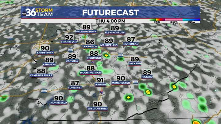
Afternoon highs will head back to average as scattered storm chances diminish
It was another warm August day across Central and Eastern Kentucky with a mix of sunshine and clouds, and highs settling into the mid-80s. A few scattered storms popped up during the afternoon, particularly in areas east of I-65, similar to Tuesday’s setup. For the spots that did see rain, it came down fast and heavy, leading to some localized flooding, gusty winds, and lightning. Meanwhile, areas that stayed dry enjoyed a fairly nice summer day with more typical humidity levels returning after the muggy stretch we saw in July.
Drying Out and Heating Up
As we head into Thursday, the upper-level system that brought midweek rain chances continues to weaken and slide east. This will open the door for a ridge of h

 WLNS 6 News
 News 5 Cleveland
 Raw Story