
 WAND TV
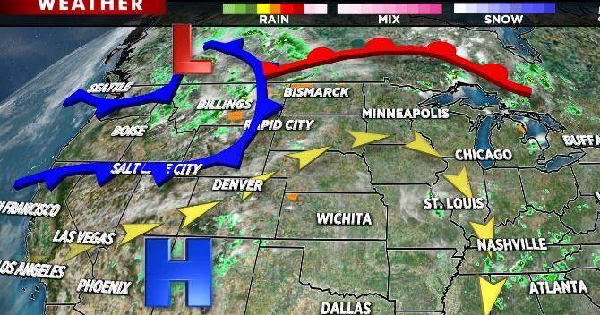
DECATUR, Ill. (WAND) - A couple clusters of thunderstorms developed earlier today on the periphery of the Southwest high pressure heat dome. While a stray shower cannot be ruled out overnight, a change in orientation to that high pressure will allow for a period of dry, hotter weather Friday into the weekend.
The storm centered over western Canada will move eastward along with its associated cold front. The cold front though will stall to our north early next week. The lower pressure ahead of that cold front will likely help trigger an occasional thunderstorm. Otherwise, summer isn't about to let go of us just yet.
If you're headed to the state fair, plan accordingly. Hope to see you out there. Stay safe and stay sweaty.

 Block Club Chicago
 People Crime
 NBC Chicago
 Daily Herald
 FOX 32 Chicago
 FOX 32 Chicago Crime
 WSIL-TV
 The Washington Post Opinions