
 WWSB
WWSB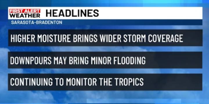
SARASOTA, Fla. (WWSB) - A weak front remains stalled across northern Florida, helping to drive our weather pattern this week. Winds near the surface have shifted more from the northeast to east, which, yesterday, caused showers and thunderstorms to pop up first along the east coast and inland areas before drifting toward the Gulf coast during the afternoon and evening hours. Expect a similar setup on today and the rest of the weekend, with the highest chances for storms later in the day, especially near the coast.
The major difference in today weather will be the amount of moisture that is moving into the region, increasing the likelihood of scattered to widespread showers and thunderstorms each day. This wet pattern is being influenced by high pressure systems sitting to our north and we

 FOX 13 Tampa Bay Crime
 Orlando Sentinel
 WTNH News 8
 FOX News
 America News
 NBC News NFL
 Crooks and Liars
 Raw Story