
 KPAX
KPAX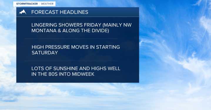
MISSOULA — Our current system and associated cold front continue to push through Western Montana on Thursday afternoon and evening.
The biggest threat from any strong to isolated severe storms will be gusty and erratic winds and small hail. We'll also see bouts of heavy rainfall, which has prompted a Flash Flood Watch until 8 p.m. for the Daly Fire burn scar & Skalkaho Pass areas of the Bitterroot and Sapphire Mountains.
Watch the forecast: Weather Forecast: 8.7.25
Overnight, lows will drop into the 40s with a few upper 30s possible for those that clear out a bit. Don't be surprised to see a light dusting of snow above 8,000' on Friday morning!
Our cool system will begin to push into eastern Montana on Friday, leaving some wrap-around moisture in the form of cloud cover and scattere

 KXLH
KXLH Daily Inter Lake
 KTVH
KTVH Independent Record
 Associated Press US News
 WLKY
WLKY SOFREP
 Raw Story
 The US Sun Sports