
Download the 27 StormTrack Weather app to receive mobile weather alerts Today’s hot and humid weather will set the stage for our next threat of potentially strong to severe storms for our Saturday afternoon and evening. After reaching high temperatures in the upper 80s and low 90s earlier on today, the mercury will gradually dwindle from 86° around dinnertime to 80° by 10 o'clock. We’ll only see temperatures dip toward as low as the mid 70s by the time we’re waking up early Saturday morning. The mild start to our Saturday will be a quiet one - we’re not expected to see any inclement weather until Saturday afternoon. The latest model data suggests we’ll reach afternoon highs in the mid to upper 80 tomorrow prior to the arrival of our storm chances. An advancing cold front is expec
Strong to severe storms Saturday
 WKOW 273 hrs ago
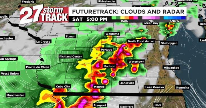
4

 Local News in Arizona
 The Travel
 The Baltimore Sun
 CNN Climate
 ABC News US
 ABC30 Fresno World
 CBS News
 FOX Weather
 Associated Press US News