
 Bring Me The News
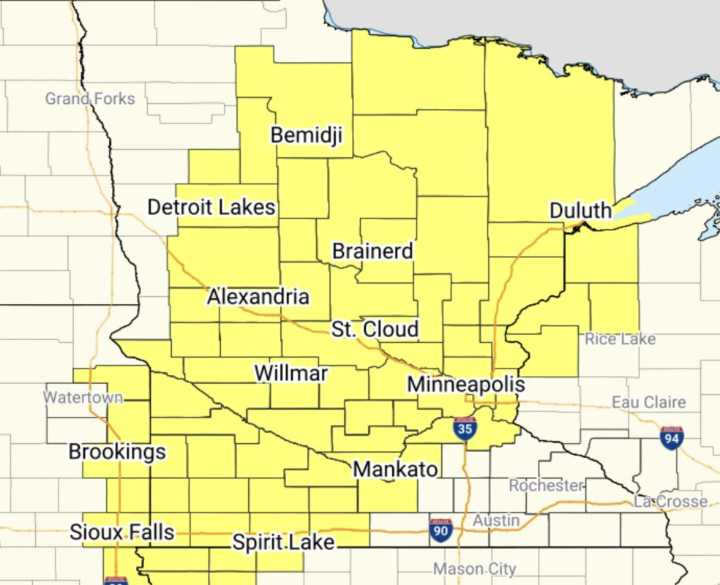
The National Weather Service has issued a severe thunderstorm watch until 4 a.m. Saturday, and it includes most of the state — including the Twin Cities, St. Cloud, Duluth and Mankato.
According to the Storm Prediction Center (SPC), scattered winds up to 80 mph are likely, along with the threat for some tornadoes and scattered hail up to two inches in diameter.
Here's how the HRRR model has the storms evolving through 6 a.m. It's not exactly robust as the large watch box might indicate.
The NAM model, however, is much more active with storms all over the state.
The SPC said prior to issuing the watch that a few supercells would be possible early on, with those isolated storms posing a threat for large hail. But then the storms would likely congeal into a line or cluster and bring an in

 Local News in Arizona
 The Travel
 ABC News US
 CBS News
 The Baltimore Sun
 CNN Climate
 KSL NewsRadio
 FOX Weather
 ABC30 Fresno World
 The Daily Beast