
 WDSU New Orleans
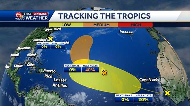
Forecast data show a strong tropical wave moving off the African Coast, if named next, could become Hurricane Erin our first hurricane of the season.
Storm activity we've been monitoring off the Mid-Atlantic Coast now shows little signs of possible development at all. It now has been given a near 0% chance of formation. Advertisement
SYSTEM 1 - CENTRAL TROPICAL ATLANTIC:
A tropical wave in the far eastern Atlantic right now, Invest 96-L, is producing a more organized, but small batch of showers and storms. Conditions are expected to become favorable in the next few days, which could allow for gradual development. A tropical depression may form by early or middle next week as the system moves north to northwest across the open Atlantic.
Forecast data continue to show this system will g

 Local News in Arizona
 The Travel
 ABC News US
 CBS News
 The Baltimore Sun
 CNN Climate
 KSL NewsRadio
 FOX Weather
 Aljazeera US & Canada