
 ABC57 News
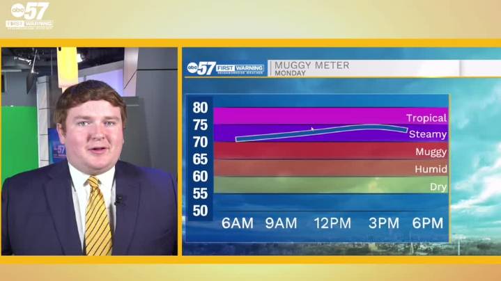
To view this video please enable JavaScript, and consider upgrading to a web browser that supports HTML5 video
The blockade of high pressure to our east is falling apart, allowing a broad cold frontal boundary to slowly pass over Michiana early this week. Pre-front, our highs today will be near 90 degrees with dewpoints in the low 70s for another hot and muggy start to the week. A few scattered showers are possible this afternoon and evening as the front gets closer to our area, but the best rain chances are reserved for later tonight and most of tomorrow. After lows bottom out near 70 degrees, we'll return to the 90s temporarily Tuesday afternoon just before the front. Scattered showers and thunderstorms will be on and off most of tomorrow with no severe weather expected. A few showers

 The Bay City Times
 The Grand Rapids Press
 Detroit News
 Detroit Free Press
 Battle Creek Enquirer
 The List
 FOX 10 Phoenix National
 TMZ
TMZ