
 ClickOrlando
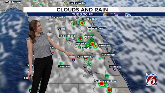
ORLANDO, Fla. – Get ready for more heat, humidity and afternoon storms across Central Florida.
With high pressure settling in and a typical summertime pattern in place, you’ll want to keep your eyes to the skies .
Tuesday
A light southeast breeze around 10 mph will develop, with a stronger sea breeze kicking in near the coast.
Storms will follow the usual summer pattern. Isolated showers and lightning storms may pop up near the coast in the early afternoon, then spread inland and become more widespread by late afternoon into early evening.
[VIDEO BELOW: Track the tropics on News 6 Weather App]
Rain chances are around 30–50% along the coast and 50–70% inland. Some of the storms could be strong, with heavy downpours, frequent lightning and wind gusts up to 40–50 mph. Most storms s

 WWSB
WWSB Sun Sentinel
 FOX 13 Tampa Bay Crime
 Tribune Chronicle Community
 WSVN 7 News
 FOX 35 Orlando
 Sarasota Herald-Tribune
 CBS4 Miami
 Raw Story