
 WJZ CBS Baltimore
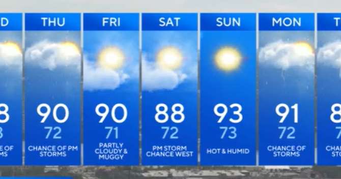
Summer is turning up the heat across Maryland this week, and the humidity isn't far behind. That classic August combo will make it feel even hotter - and keep daily thunderstorm chances in play.
The pattern is shifting as high pressure slides offshore, letting warmer, moisture-packed air flow in. By Thursday, a weak front will be moving our way, stirring up the atmosphere and giving us a better shot at those pop-up afternoon and evening storms.
Tuesday afternoon brought highs in the upper 80s to low 90s across much of the state. Morning clouds gave way to sunshine, but a few showers managed to bubble up - mostly in the mountains - with a stray cell possible closer to the Bay. Any storms will fade quickly after sunset, and the night will stay warm and muggy with lows in the 70s. Expect so

 Detroit Free Press
 Sweetwater Now
 KSNB Local4 Central Nebraska
 CBS News
 Associated Press US and World News Video
 MyNorthwest
 Daily Voice
 WMTV NBC15
 IMDb TV