
 WYFF News 4
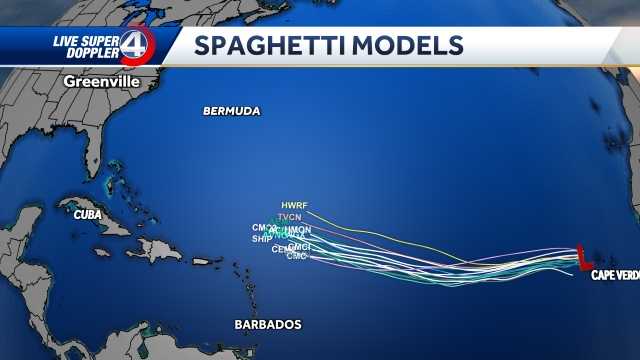
Tropical Storm Erin is on track to strengthen into a major hurricane in the coming days. It’s forecast to strengthen into our first hurricane of the Atlantic season by Friday afternoon and into a major hurricane by early Sunday morning.
For now, most forecast guidance keeps Erin over open waters through the week, with many models showing a classic northward “recurve” that would steer the storm away from the U.S. coastline. However, the European model has at times suggested a closer track — potentially brushing parts of the East Coast.
Forecast models continue to show it making a north turn Sunday into Monday, away from the U.S.
Hurricane track:
Hurricane Track
Much will depend on Erin’s strength in the short term. A quicker intensification would make it more likely to curve north soon

 Detroit Free Press
 WDSU New Orleans
 Newsweek Top
 America News
 KTOO
KTOO Press-Enterprise
 FOX Weather
 The Daily Sentinel
 New York Post
 CBS News
 Spectrum News Louisville
 Glam
Glam