
 WKYT
WKYT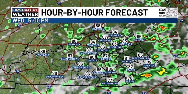
LEXINGTON, Ky. (WKYT) - Scattered storms are rumbling through for the middle of the week, but they’ll ease up this weekend as steamy air builds in. By next week, the weather pattern starts to take on more of a September feel.
Today’s showers and storms will come in clusters, leaving plenty of dry breaks in between. Any storm that pops up could pack a punch with frequent lightning and heavy downpours, which may lead to localized flooding. Highs today will range from the mid-80s to around 90.
A few isolated storms stick around Thursday and Friday, with highs holding steady in the 85–90° range. The heat ramps up this weekend into Monday, bringing upper 80s to low 90s and a steamy stretch for the middle of the month.
Meanwhile, Tropical Storm Erin continues spinning in the Atlantic. Forecas

 Essentiallysports Basketball
 The Babylon Bee