
 The Monroe News
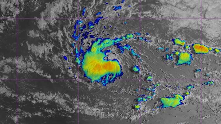
Tropical Storm Erin continues to travel west and is on pace to strengthen into the season's first major hurricane by the end of this week, the National Hurricane Center said.
According to a 5 a.m. ET advisory from the NHC on Aug. 13 , Erin was located about 1,400 miles east of the northern Leeward Islands with maximum sustained winds around 45 mph with higher gusts. Erin is currently moving west near 20 mph, and this motion is expected into Thursday, according to forecasters.
A west-northwestward motion is expected to begin Thursday night and will continue into the weekend, with the center of Erin likely to move near or just north of the northern Leeward Islands over the weekend.
"Gradual strengthening is forecast to begin today, and Erin will likely become a hurricane by late Thursd

 CBS Philly
 CBS Mornings
 America News
 KTOO
KTOO Press-Enterprise
 Columbia Daily Tribune
 FOX Weather
 Florida Today
 The Daily Sentinel
 New York Post
 CNN
CNN