
A cold front slides southeast Thursday but don't expect much relief from the heat and humidity, or much in the way of showers and storms. We'll end up partly sunny with isolated showers and storms in the afternoon, watch for gusty wind and locally heavy rain. Highs will top out around normal, in the upper 80s. High pressure takes over heading into the weekend and another heat wave will slowly build. Expect highs to climb from the low to mid 90s into early next week. With muggy air not going anywhere, the heat index will push triple digits at times. Isolated afternoon showers and storms are possible, but most will stay hot, humid and quiet until showers and storms fire up again toward the middle of next week.
Another Heat Wave Inbound this Weekend
 LEX 18 News6 hrs ago
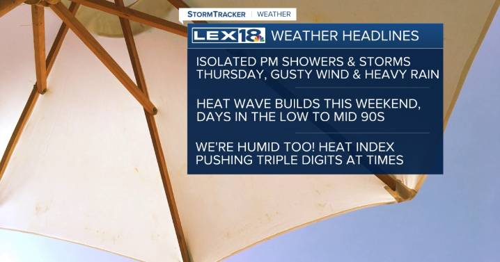
55

 Local News in Maine
 Newsweek Top
 Associated Press US and World News Video
 Eyewitness News 3
 MyNorthwest
 TMJ4 News
 KONP
KONP AccuWeather Severe Weather
 AlterNet