
 ClickOrlando
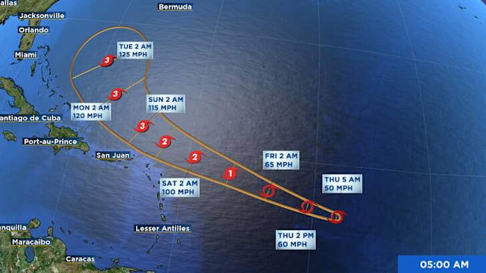
ORLANDO, Fla. – Tropical Storm Erin on Thursday continues to gain strength in the open Atlantic.
While its exact path remains uncertain, the storm is expected to become a powerful hurricane over the weekend.
Strengthening and Watching Closely
Erin continues to spin in the central tropical Atlantic, with sustained winds near 50 mph. Satellite imagery shows some ongoing development.
The environment around Erin is expected to become more favorable for strengthening over the next 24–48 hours. As the storm moves over warmer waters and experiences slightly lower wind shear, models indicate a window for rapid intensification beginning late Friday or Saturday. If that trend holds, Erin could become a major hurricane by early next week. No description found
Erin is currently tracking wes

 Raw Story
 People Top Story
 Rolling Stone
 Billboard
 The Conversation
 The List
 AlterNet
 Orlando Sentinel Travel
 Essentiallysports Football