
 WFMY News 2
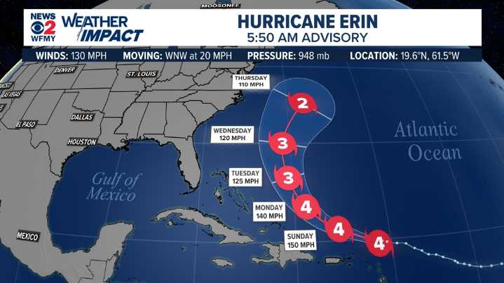
GREENSBORO, N.C. — Erin is now a category 4 hurricane. The big question is will Erin pose a threat to the U.S. East Coast?
As of 5:50 AM Saturday, Erin has sustained winds of 130 mph moving west-northwest at 20 mph. The storm is currently located north of the of the Northern Leeward Islands.
Here's the latest forecast cone from the National Hurricane Center.
Video Forecast
Impacts to East Coast?
As of now, models are still generally in agreement that Erin will continue to move west-northwest before turning more northward. This would likely avoid a direct hit on the East Coast.
The key factor steering Erin is a strong ridge of high pressure over the central Atlantic. As long as that ridge holds, the storm should stay out to sea.
It's worth noting, though, that a storm that stays off

 WCCB Charlotte Crime
 Esquire
 AlterNet
 Atlanta Black Star Entertainment
 Raw Story
 The US Sun Health
 WIRED
WIRED