
 Gizmodo
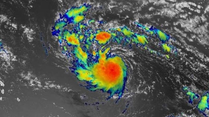
Tropical Storm Erin is on track to reach the Caribbean this weekend, with current forecasts predicting it will curve north of the Leeward Islands and Puerto Rico without making landfall. Still, Caribbean nations are bracing for severe storm impacts as Erin moves into warmer waters, increasing the risk of rapid intensification.
A National Hurricane Center update issued at 5 a.m. AST Thursday, August 14, stated that Erin should gradually strengthen over the next day or so. After that, the storm will encounter warmer sea surface temperatures and slightly less wind shear. These conditions are conducive for rapid intensification, an increase in the maximum sustained winds of a tropical cyclone of at least 30 knots in a 24-hour period. If this storm does rapidly intensify, it will do so w

 America News
 Kitsap Sun
 WTAJ-TV
 The Denver Post
 Sarasota Herald-Tribune
 NBC News
 AlterNet