
 Gizmodo
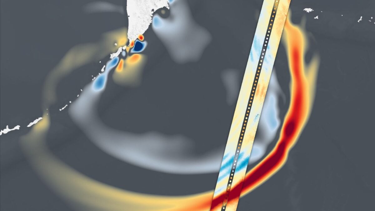
In late July, the sixth biggest earthquake in recorded history struck off the coast of Russia’s Kamchatka Peninsula. The magnitude 8.8 quake triggered a tsunami that sent waves across the Pacific, prompting widespread warnings and some evacuation orders.
Data released Thursday, August 14, by NASA Earth Observatory captures this global event in striking detail. The Surface Water and Ocean Topography (SWOT) satellite, a joint venture between NASA and the French space agency CNES (Centre National d’Études Spatiales), recorded the tsunami’s leading edge about 70 minutes after the earthquake struck. In the animated graphic below, the darkest red spots mark places where the wave rose more than 1.5 feet (0.45 meters).
“A 1.5-foot-tall wave might not seem like much, but tsunamis are waves that

 America News
 Kitsap Sun
 WTAJ-TV
 The Denver Post
 Sarasota Herald-Tribune
 New York Post Opinion