
 KWWL
KWWL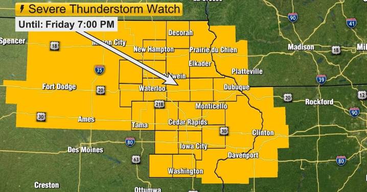
A Severe Thunderstorm Watch is in effect for ALL of eastern Iowa through 7 PM. A line of storms will be capable of producing severe wind gusts and torrential rainfall. Some small hail is possible. The airmass is currently very unstable with a lot of humidity, allowing for a continued severe threat as the storms move east. Take shelter away from windows and on the lowest level of your home as the storms come through.
Ton ight [LEVEL 2 OF 5 SEVERE RISK] : The current batch of strong to severe storms are expected to move through this evening. Additional storm chances look possible, mainly for areas north of Highway 20, overnight where more strong wind gusts are possible. Otherwise, it is a partly cloudy, warm, and humid night with lows in the low to mid 70s. Winds are southerly

 New Jersey News
 KOMU 8
 Fosters Daily Democrat
 AccuWeather Severe Weather
 Oh No They Didn't
 Atlanta Black Star Entertainment
 AlterNet
 Essentiallysports College Sports
 TIME
TIME