
 WCTV
WCTV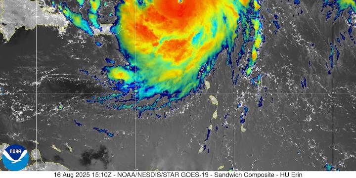
TALLAHASSEE, Fla. (WCTV) - On Saturday afternoon, Hurricane Erin is a major hurricane and is expected to remain one through the middle of next week as the cyclone turns north.
The largest impacts from Erin will be high waves and dangerous surf along the Atlantic coast. We will be monitoring the motion of Erin over the next few days.
North Florida or South Georgia will NOT see impacts from Erin.
If you want to stay updated with the tropics, we have plenty of free tools to track tropical weather with us:
The FREE WCTV Weather App
Weather Articles and updates on the web
First Alert Daily Weekdays at 2:00 p.m.
First Alert Weather NOW for 24/7 access to WCTV’s weather
Click here to see all the latest weather headlines and here to view the First Alert Radar. Receive push

 WCNC Charlotte
 WYFF News 4
 The Free Press - TFP
 Associated Press Top News
 WWSB
WWSB Orlando Sentinel
 KLCC
KLCC WSVN 7 News
 WESH 2 News
 13WMAZ
 FOX 11 Riverside County
 Washington Examiner