
 Savannah Morning News
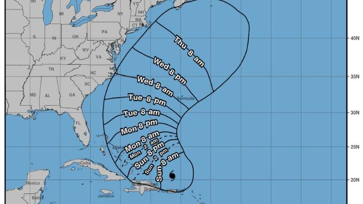
Hurricane Erin will not be making landfall in the southeastern U.S., according to the National Weather Service's briefing at 5 a.m., Aug. 17. The storm "will pass well offshore through the coming week," wrote the NWS.
At 2 a.m., Erin was downgraded to a Category 3 hurricane. As of 8 a.m., its wind speeds have slowed to 125 mph.
While its intensity fluctuates, Erin is still growing in size—and its effects are far-reaching. "Tropical storm-force winds extend outward up to 205 miles from its center," wrote the NWS.
Erin's core will likely pass east of the Turks and Caicos Islands and the southeastern Bahamas tonight and Monday. And as it moves north of the Caribbean, Erin will leave powerful ripple effects along the U.S. East Coast. Starting Monday, large swells will create rip currents at

 America News
 CNN
CNN KRWG Public Media
 Associated Press Top News
 People Human Interest
 Associated Press US and World News Video
 Raw Story
 The Telegraph