By Joe Lombardi From Daily Voice
Hurricane Erin had grown into a monstrous force in the Atlantic, and its next move could spell trouble for some of the East Coast’s most vulnerable spots.
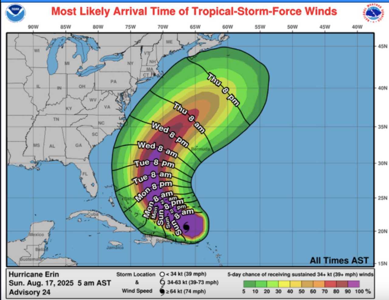
Packing winds that peaked at 160 mph, Erin has weakened to a still-dangerous Category 3 storm Sunday morning, Aug. 17, churning up life-threatening surf and rip currents from the Carolinas to New England.
The National Hurricane Center warns that the storm’s path over the next few days will be crucial in determining whether North Carolina’s Outer Banks, New York's Long Island, and Cape Cod, Massachusetts, face direct impacts or are spared the worst.
As of Sunday morning, Erin was producing heavy rain and gusty winds across Puerto Rico and the Virgin Islands, with flash flooding and landslides possible. The storm is expected to move northward, staying hundreds of miles offshore, but its massive size means dangerous conditions will reach far beyond its center
.Forecasters say the greatest threats to the US East Coast this week will be powerful waves, coastal flooding, and frequent, strong rip currents.
Beaches from Florida to Atlantic Canada are likely to see breakers of 5-10 feet, with even higher waves — up to 15 feet — possible in protruding areas like the Outer Banks, eastern Long Island, and Cape Cod, according to AccuWeather.
The exact track of Erin remains uncertain. If high pressure over the Atlantic shifts, the hurricane could drift closer to the coast, increasing the risk of tropical storm or hurricane conditions for these exposed regions.
Even if Erin stays offshore, access roads such as NC 12 on the Outer Banks could be inundated by storm surge and wave action.
"Beaches along the entire East Coast, from Florida to New England and Atlantic Canada, will likely experience rough surf and dangerous rip currents as Erin tracks north and eventually northeast," AccuWeather Lead Hurricane Expert Alex DaSilva said.
Officials urge anyone heading to the beach this week to heed warnings, swim only where lifeguards are present, and stay alert for rapidly changing conditions.
The coming days will be critical as meteorologists watch Erin’s path and its potential to threaten the US coastline.
Check back to Daily Voice for updates.
.

 Daily Voice


 WSVN 7 News
 New York Post
 ABC News
 People Crime
 Newsweek Top
 The Babylon Bee