
 KTLA
KTLA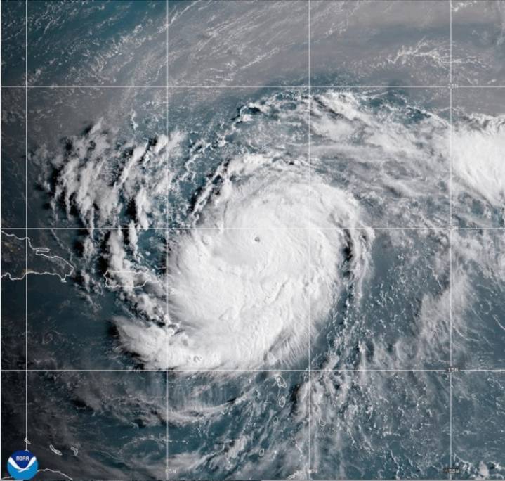
As Hurricane Erin intensified rapidly into a Category 5 storm, a team of storm chasers got a closer look from the eye of the hurricane, and it was all caught on video.
The footage was posted by the National Oceanic and Atmospheric Administration (NOAA) on Saturday. It shows the NOAA’s Hurricane Hunters flying directly into the storm, which generated sustained winds of 160 miles per hour on Saturday while churning in the Atlantic Ocean north of the U.S. Virgin Islands and Puerto Rico.
Several Caribbean nations and islands were under various watches and warnings due to Erin, including the U.S. Virgin Islands, Puerto Rico, Turks and Caicos and the northern Leeward Islands. As of Sunday, they were mainly concentrated in the Bahamas. • This satellite image provided by NOAA shows Hurricane E

 FOX News Videos
 NBC News Video
 New York Post Video
 WISC-TV Channel 3000
 FOX 13 Tampa Bay Crime
 AccuWeather Severe Weather
 New York Post
 Canada News
 People Human Interest
 The US Sun Latest
 Seeking Alpha Stock