
 FOX 13 Tampa Bay Crime
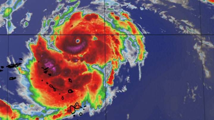
Hurricane Erin has developed into a Category 5 hurricane as of Saturday morning, according to the National Hurricane Center.
Winds have now reached 160 MPH which makes it a category 5 on the Saffir-Simpson Hurricane Wind Scale.
Erin is currently north of the Caribbean islands as it moves west.
This weekend, the path of Erin is expected to pass north of the northern Leeward Islands, the NHC says.
Impacts of the hurricane have already been felt throughout the Leeward Islands, the Virgin Islands and Puerto Rico but they are not expecting a direct hit.
The Caribbean Islands should see about 2–4 inches through Sunday and totals could reach up to six inches.
Tropical Storm Watches are in place for St. Martin, Sint Maarten, and St. Barthelemy, with Flood Watches for Puerto Rico and the U.S.

 News on 6
 Daily Voice
 WMBD-Radio
 WISC-TV Channel 3000
 AccuWeather Severe Weather
 New York Post
 Canada News
 People Human Interest
 RadarOnline