
 ClickOrlando
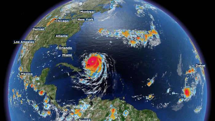
ORLANDO, Fla. – Hurricane Erin is flexing its muscles in the open Atlantic, growing larger and more powerful.
As of Monday morning, Hurricane Erin was packing sustained winds of 130 mph, with hurricane-force winds reaching 70 miles from the eye and tropical-storm-force winds extending 200 miles out. No description found
The storm has developed a larger eye (about 30-miles wide) and may be undergoing an eyewall replacement cycle, which could briefly increase its size further before a slow weakening trend begins late Tuesday.
While the core of Erin will remain far offshore, its expanding wind field is already driving long-period swells toward the Florida coast. Erin Coastal Impacts
What to Expect in Central Florida
Rip currents and dangerous surf will persist through the week.

 KY3
KY3 SIAdvance
 Daily Voice
 FOX 13 Tampa Bay Crime
 Orlando Sentinel
 FOX 35 Orlando
 Law & Crime
 AlterNet