
 The Jersey Journal
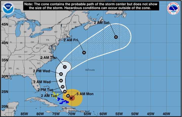
A high risk of dangerous rip currents is expected this week at the Jersey Shore as Hurricane Erin passes off the coast, with potential beach erosion and flooding threatening New Jersey’s shoreline communities.
The National Weather Service has issued a high rip current risk from Monday morning through Tuesday evening for coastal areas and it is likely to be extended as the week progresses.
“Erin will be felt even though Erin is forecast to stay well offshore,” the weather service said early Monday. “Coastal flooding, high surf, dangerous rip currents, and beach erosion are all potential impacts.”
Residents and visitors are advised to avoid swimming and remain cautious near coastal areas, the weather service said.
Hurricane Erin strengthened to a Category 4 storm overnight with maximum s

 Eyewitness News 3
 WKOW 27
 KETV Omaha
 Wilmington Star-News
 KSNB Local4 Central Nebraska
 K2 Radio Local
 The Week
 The Oregonian Public Safety
 Ocala Star-Banner
 New York Post Opinion