
 WWSB
WWSB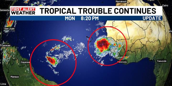
SARASOTA, Fla. (WWSB) - Thankfully Erin will miss our coast as it moves northward and then to the NE into the open waters of the Atlantic over the next few days. There is something behind it that we will be watching closely.
The next area of concern is in the eastern Atlantic is disturbance #1, and has a good chance of developing into the next named storm, Fernand. The chances for developing over the next several days has gone up to 60% as the tropical wave moves toward the west at 20 mph.
Both the EURO and the American (GFS) models are showing a tropical cyclone or named storm developing this weekend from this first disturbance or tropical wave.
Since the storm hasn’t even developed as of yet it is too early to tell if it will even have an impact on Florida at this time so no worries p

 Orlando Sentinel
 WCNC Charlotte Weather
 FOX 13 Tampa Bay Crime
 Jacksonville Daily Record
 The Spectator
 NBC News
 MLB
MLB RadarOnline
 FOX Business