
 The Advocate
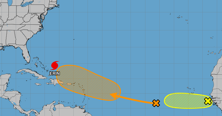
Hurricane forecasters highlighted another tropical wave near Africa Monday evening as they continued to track Hurricane Erin and a disturbance over the central Atlantic Ocean that is becoming more likely to form.
Located just off the west coast of Africa, the new wave was producing a "persistent" cluster of showers and thunderstorms and moving west at about 15 mph as of 7 p.m. Monday, according to the National Hurricane Center.
While the system could develop some over the next day, forecasters said further strengthening will likely be halted Thursday by harsh environmental conditions. As of 7 p.m., the wave had a 10% chance of developing within the next two days.
The wave does not pose an immediate threat to Louisiana, and forecasters with the National Weather Service of New Orleans sai

 Local News in South Carolina
 Orlando Sentinel
 America News
 KRWG Public Media
 WCNC Charlotte Weather
 Sarasota Herald-Tribune
 Chicago Star Media
 AccuWeather Severe Weather
 The Federick News-Post Sports